& Construction

Integrated BIM tools, including Revit, AutoCAD, and Civil 3D
& Manufacturing

Professional CAD/CAM tools built on Inventor and AutoCAD
InfoDrainage enables designers, engineers, consultants, developers, reviewers, hydraulic modelers, approving authorities, and water companies to design and audit drainage systems.
Create designs for traditional and sustainable drainage (SuDS), with tailored reports for compliance
See the accurate-to-reality extent of a pond, how the underdrain connects swales, and the exact lengths of pipes as designed
Update pipe networks and surfaces to maintain 3D models for BIM compliance with integrated data exchange with round-tripping support in Civil 3D
Use built-in detailed hydraulic analysis for pipes, manholes, storage, and green infrastructure to reduce the risk of flooding downstream
Speed up the design process with easy drag-and-drop templates set up to meet regulatory compliance
Use validation to quickly spot highlighted errors and read warnings, with potential solutions proposed
Run a wide range of rainfall and runoff calculations in the cloud to enhance speed and accuracy
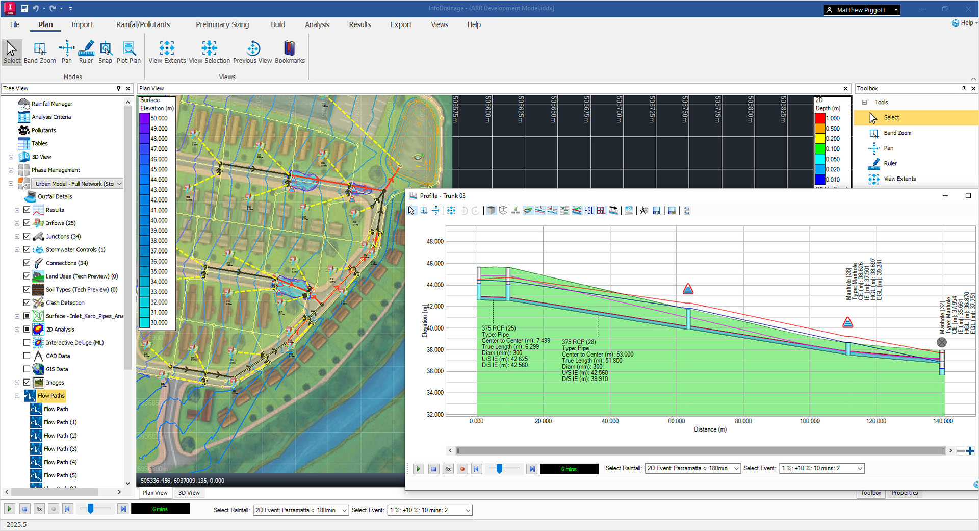
Switch between profile, plan, and 3D views to visualize how much space you are using and how your system is connected
Quickly generate drainage reports in the styles and formats you need for design approval
Quickly identify overland flow patterns with deluge analysis, including new machine learning powered by Autodesk AI
Leverage InfoDrainage for USDOT transportation and highway projects with built-in Federal Highway Association (FHWA) Culvert Analysis
Embrace the cutting edge of Autodesk AI with Machine Learning Deluge to understand ponding and channeling on a site surface
ENHANCED
Flexible reporting
Generate drainage reports quickly by exposing all of the available inputs, outputs, simulation results, design results, calculated values, etc., all in one table based on connectivity. (video: 10:45 min.)
NEW
Simulation Health Reporting
Identify and address simulation errors without the need for extensive guesswork and manual checking. The tool highlights where the problem is and which storm is associated with it. A "go to" button enables you to jump directly to the problematic element, saving time and effort in troubleshooting. (video: 35 sec.)
Hydraulic Grade Line and Energy Grade Line
Plot the Hydraulic Grade Line (HGL) and Energy Grade Line (EGL) within the long section of the drainage network. (video: 29 sec.)
Clash Detection Analysis
Enhance the design process with Clash Detection Analysis. Identify and visualize "clashes" or intersections between different components within your design, such as pipes, channels, or other structures. (video: 1:24 min.)
Machine Learning Deluge
Generate responsive flood maps utilizing the new Machine Learning Deluge tool, powered by Autodesk AI. Identify patterns between the ground model and the resulting flood map, then see hotspots to establish the best locations for storage structures and stormwater controls. (video: 44 sec.)
NEW
FHWA Culvert Analysis
Users now have access to a comprehensive selection of 57 culvert types, including circular, box culverts, ellipses, and arches, with various shapes and entrances. This new feature enables more accurate and detailed modeling of culvert behavior, enhancing the overall drainage design process.
NEW
Land use and soil type polygons
Land use and soil type polygons allow you to incorporate detailed polygon attributes to refine hydrological calculations for each sub-catchment, providing a more accurate and spatially informed approach to drainage design.
ENHANCED
Civil 3D integration
Civil 3D round-tripping enables seamless connections between your civil design and hydraulic analysis process. Export catchments from Civil 3D with the toolbar and make responsive changes in InfoDrainage, including direct results migration between platforms.
Cloud analysis
Run a variety of rainfall and runoff calculations for your region in the cloud. Both 1D and 2D analysis involving rainfall and runoff calculations can now be processed in the cloud, enhancing design workflows through a robust, multi-regional data center architecture.
HEC-22 inlet analysis
HEC-22 inlet calculations now account for the grate type and the throat angle, both critical factors affecting water inflow rates into the inlet. By incorporating these parameters, we aim to provide a more realistic representation of how drainage inlets perform under varying conditions.
NEW
Backwards compatibility
InfoDrainage 2026 includes backwards compatibility, allowing you to work with both InfoDrainage 2025 and Civil 3D 2025 — simplifying the process of sharing models and eliminating compatibility issues.
ENHANCED
Desbordes Rainfall
Extended shape added to the Desbordes French Rainfall with additional durations up to two weeks.
Part-family awareness
You can specify materials for pipes and structures/manholes to control the cost and durability directly within your project.
