& Construction

Integrated BIM tools, including Revit, AutoCAD, and Civil 3D
& Manufacturing

Professional CAD/CAM tools built on Inventor and AutoCAD
Autodesk XPSWMM is an integrated 1D/2D modeling solution for stormwater and wastewater management supporting urban planning, growth, and flood mitigation efforts.
Create 1D and 2D hydrodynamic models for detailed analysis of stormwater, wastewater, and combined sewer systems.
Simulate rainfall runoff processes in urban watersheds to understand and manage water flow.
Analyze water quality to mitigate undesirable overflows.
Autodesk XPSWMM is an integrated 1D/2D modeling solution for stormwater and wastewater management supporting urban planning, growth, and flood mitigation efforts.
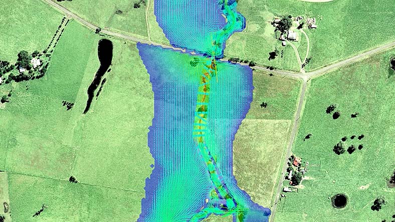
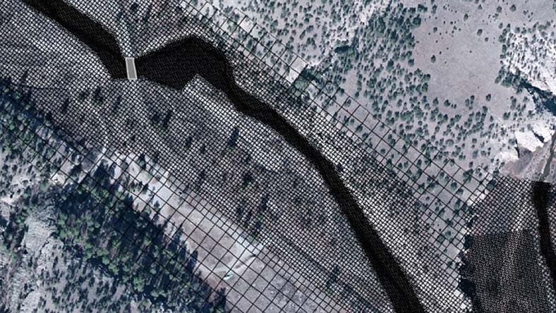
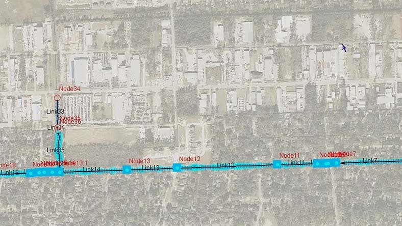
XPSWMM integrated 1D/2D modeling
XPSWMM 1D dynamic cross section results analysis
XPSWMM dynamic long section design and analysis
XPSWMM river flooding results analysis
XPSWMM flooding simulation results with cross section analysis
Create 1D and 2D hydrodynamic models for detailed analysis of stormwater, wastewater, and combined sewer systems.
Simulate rainfall runoff processes in urban watersheds to understand and manage water flow.
Analyze water quality to mitigate undesirable overflows.
Combine hydrology and hydraulics to understand water flows.
Simulate scenarios like combined sewer overflows and urban flooding.
Meet requirements of worldwide environmental programs, including the NFIP.
Support sustainable urban planning and growth.
Use 1D and 2D modeling to analyze complex interactions between surface and subsurface water systems, including overland flow and channel networks. Import GIS, CAD, HEC-RAS data, and more for efficient model building.
CUSTOMER STORY
HDR combines data from ICMLive, HEC-RAS, HEC-HMS, and XPSWMM to model the impacts of a superstorm.
BLOG
Take advantage of cloud computing by importing XPSWMM models into InfoWorks ICM with the XP Importer.
CASE STUDY
ISG relied on XPSWMM for many years, giving them the baseline data they needed to expand to new tools.
Autodesk XPSWMM is a software application used for simulating hydrologic and hydraulic systems, aiding in stormwater and wastewater management, floodplain mapping, and river modeling. It enables the design and analysis of urban drainage systems, sanitary sewer networks, and natural watercourses, helping predict and mitigate flooding, optimize infrastructure, and ensure regulatory compliance. Autodesk XPSWMM supports integrated water resources management by evaluating watershed hydrology, pollutant transport, and the impacts of land-use changes and climate change. It is an essential tool for engineers, planners, and environmental professionals focused on sustainable and resilient water resource management.
Autodesk XPSWMM is used by civil and environmental engineers, urban planners, government agencies, municipalities, consulting firms, academic researchers, utilities, and construction companies. These professionals and organizations rely on Autodesk XPSWMM to design, analyze, and manage stormwater, wastewater, and natural water systems. They use the software to predict flooding, optimize infrastructure, ensure regulatory compliance, and support sustainable water resource management and development planning.
Autodesk XPSWMM is available in two product tiers: XPSWMM Sewer and XPSWMM Complete.
XPSWMM Sewer includes:
1D modeling for sanitary sewer networks (excludes river analysis and 2D flood capabilities)
XPSWMM Complete includes:
Integrated 1D/2D modeling for stormwater and sanitary sewer networks
Capabilities previously available in Innovyze XPStorm
All former Innovyze add-on licenses for GPU and multiple domains
Contact us for more information and pricing for these offerings.
XPSWMM and InfoWorks ICM are both software solutions for modeling and managing water systems and infrastructure. InfoWorks ICM is the most advanced and highest fidelity storm, sewer, and flood modeling solution on the market. It allows the modeling of entire urban cities or regional systems if needed.
One of the key advancements of InfoWorks ICM is that it supports terrain-sensitive meshing, unlike XPSWMM's fixed grid system, which saves time and improves model quality. Additionally, InfoWorks ICM handles large data sets and complex flow conditions more effectively across multiple catchments and provides more advanced analysis tools, including various infiltration methods and scenario management. Learn more about the differences between XPSWMM and InfoWorks ICM in this blog.
Your XPSWMM subscription gives you access to install and use the 3 previous versions. Available downloads are listed in your Autodesk Account after subscribing. See also previous releases available for subscribers. If you require older versions of XPSWMM, please contact customer support.
XPSWMM Sewer and XPSWMM Complete are is available as Multi User subscriptions, and are subject to the Multi User terms and conditions included in the Software License Agreement as well as any product-specific terms included therein.
XPSWMM runs on Microsoft® Windows®. See XPSWMM system requirements for details.


